Cartography as Reconciliation
Written by Randy Klassen
I can remember it like it was yesterday. It was my first week of grade two—half a century ago, now—and my teacher had inscribed the wrong form of my name on my notebooks. It was a well-intentioned but careless act. Bad enough that she had written my full given name—the moniker I only heard from my mother, and that, only when she was displeased with me. But that my teacher had written it with a (Germanic) final “f”, rather than the proper (English) “ph”—”Randolf”—was an indignity not to be tolerated!
My seven-year-old self eventually forgave her. But the lesson remains: names matter. To be known by name, to be remembered by name, is one of the great gifts one person can give another, in building and maintaining strong and respectful relationships. Names also matter when it comes to geography.
One of the many profoundly destructive acts of colonial presence is the renaming of landmarks. As the European explorers came and claimed Turtle Island, they mapped and they named landmarks. They (we!) generally obliterated the accumulated wisdom of millennia of close living with the land, a wisdom encoded in toponyms, story, and ceremony tied to specific locales.
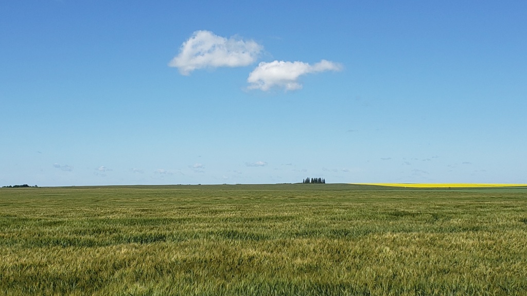
The spruce-clad hill of Stoney Knoll rises in the distance above the Saskatchewan prairie within the lands of Reserve 107. (MCC photo/Randy Klassen)
Certainly, not all names were lost, a fact which underscores the importance of, and reliance upon, the First Nations guides and knowledge keepers in the earlier stages of colonial contact. Many labels on the map of Canada (including the country itself, and six of its 14 provincial/territorial names) belie Indigenous origins. Though it should be admitted that only one, Nunavut, is a toponym chosen by Indigenous peoples.
The colonial imprint on our maps is unmistakeable, and pervasive. I write this from a western Canadian vantage, from my roots in British Columbia (as opposed, I suppose, to the American-claimed region of the Columbian watershed, south of the 49th parallel; “Columbia” comes from the river, via a Boston fur-trader’s boat, and ultimately from Christopher Columbus himself). The Crown, in the person of Queen Victoria, became prominent in our geography during the period of western colonial expansion: Victoria (named 1843) and Regina (“Queen,” 1882), Prince Albert (1866), Alberta (Victoria’s fourth daughter, Princess Louise Caroline Alberta, 1882). Earlier members of that dynasty are also incorporated into the nation’s cartographic narrative: Queen Charlotte (wife of King George III), her son Prince Edward (father of Victoria), even the German duchy of Braunschweig (Brunswick) that was “owned” by George III. At the least, we might take these monarchical place names as a constant reminder of the Crown’s importance, and the Crown’s obligations, in our current on-going treaty relationships.
Underlying the myriad acts of naming, however, is a basic orientation that regards Indigenous local knowledge as irrelevant and/or doomed to extinction. It’s part of the larger colonial narrative of “empty land,” terra nullius, awaiting (Eurocentric) organization, settlement, and development. The act of (re)naming became an act of conquest.
Canadian cartography thus calls for acts of reconciliation. We have seen some large-scale acts of renaming in recent years. The Salish Sea and Haida Gwaii both became official geographic designations in 2010, as local First Nations called for names that reflected and honoured their place on the West Coast.

English / Cree bilingual sign erected in September 2015, marking a central and sacred site within the lands of Reserve 107. (MCC photo/Randy Klassen)
Smaller scale acts are being undertaken across the country as well. North of Saskatoon lies a tract of farmland also known as Indian Reserve 107, awarded at Treaty 6 signing in 1876 to the Young Chippewayan Band. And in the middle of this rich farmland stands a slight rise, commanding a panoramic view of the region, all the way to the North Saskatchewan River a few kilometres to the northwest. It is opwashemoe chakatinaw, “Stoney Knoll”* —and it is a special place, a “thin space” to the spiritual sensibilities of many, both Indigenous and settler. And it is a contested space. For barely two decades after Treaty signing, the Canadian government reappropriated this reserve land without consultation or consent, and sold it to Mennonite and Lutheran settlers. The Lutherans built a church on the hill, which lasted several decades; the cemetery is still there.
In a story told better elsewhere, since the 1970s the Young Chippewayan plight has come to public awareness. MCC Saskatchewan has been working with members of the Mennonite and Lutheran settler communities and the Young Chippewayan Band. One milestone was a 2006 signing of a Memorandum of Understanding for the three groups to work together towards Treaty justice.
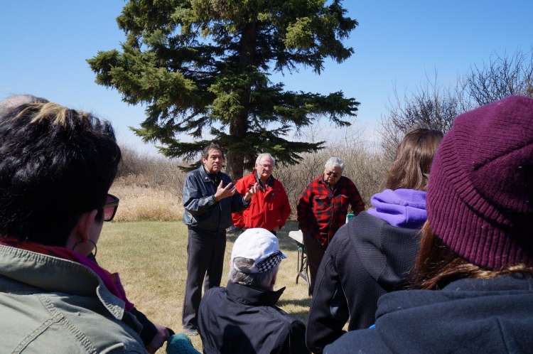
Harry Lafond (Executive Director of the Office of the Treaty Commissioner), local Mennonite landowner Ray Funk, and Young Chippewayan band hereditary chief George Kingfisher speak to gathered students on the history and significance of opwashamoe chakatinaw / Stoney Knoll, April 2015. (Photo courtesy of Rosthern Junior College).
A second milestone came in 2015. Several local residents initiated a petition to restore the Cree name of the beautiful Stoney Knoll. Students at the local Mennonite high school were invited to hear the stories of this land, its displaced Indigenous peoples and its settlers. And then, at a ceremony on site, the students and others signed the petition to add the Cree name to local signage. The petition was brought to the local Rural Municipality office, which was very receptive to the idea. On the first of September 2015, a new bilingual sign was erected.
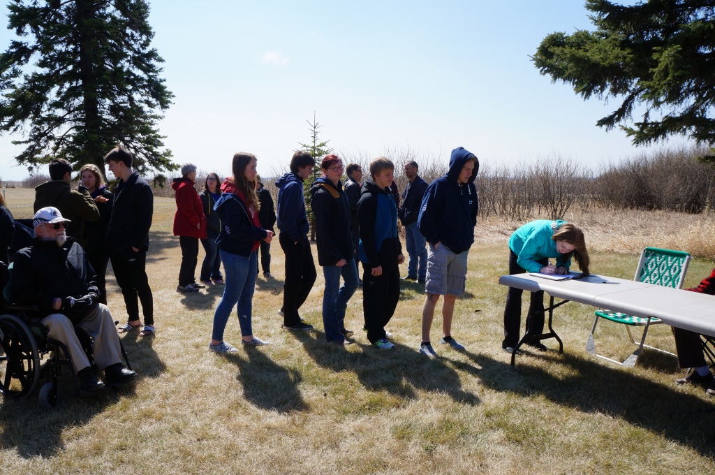
Students from nearby Rosthern Junior College gather at Stoney Knoll in April 2015, to sign a petition asking for a bilingual sign to mark this sacred site. (Photo courtesy of Rosthern Junior College)
A small act of reconciliation, whether judging by the scale of Canadian geography or Canadian justice. The Young Chippewayan Band’s path to recognition and reparation is still long. But this act, and others like it, represent a moment of cartographic reconciliation, peacebuilding on the land, with the land. It is more than symbolic. It is a concrete act of respect, a reconnection of land and language, two essential elements of Indigenous cultures. As such it honours the TRC’s Calls to Action #13-14, which deal with the importance of language and culture. The sign beside a gravel road becomes part of the larger journey towards healing from the traumas of Indian Residential Schools. It also underscores the importance of supporting and encouraging Indigenous language use, as Canada’s Bill C-91 “The Indigenous Languages Act” attempted last year, the International Year of Indigenous Languages.
The move to recover and reclaim historic Indigenous place names, and/or create new ones, is part of the journey of reconciliation. It’s not about eradicating Settler toponyms, but respecting and fostering Indigenous ones. These names bring a potent, local focus to larger cultural realities of language, history, economy, and spirituality. As such they occupy a unique and necessary place in Indigenous life. They need to be respected, with a respect that is meaningfully grounded in Canadian law and policies.
But respect can also start at the most basic, personal and community level. It can start by us asking ourselves: where do we live? What names tell the story of the places significant to us? How is Indigenous presence represented in these toponyms? Is it honoured, obscured, misrepresented, ignored? Finally, what work is being done to reconnect land and language where we live, and how can we be an ally in that effort?
Randy Klassen is the Indigenous Neighbours Coordinator for MCC Saskatchewan
Take action:
As people of faith we are committed to addressing the legacy of harm done to Indigenous Peoples by churches and governments, and to forging right relationships. In response to the Truth and Reconciliation Commission (TRC) Calls to action #48 and #49, we are calling on governments and churches to adopt and implement the United Nations Declaration on the Rights of Indigenous Peoples (UN Declaration).
Join us and send a message to the Minister of Justice and your Member of Parliament here.
Learn more:
- Reclaiming Indigenous Place Names (Yellowhead Institute, 2019)
- Overcoming the Doctrine of Discovery at Opwashemoe Chakatinaw /Stoney Knoll (MCC Intersections: Jan 2018)
- Reserve 107: Reconciliation on the Prairies (2016 documentary)
- Young Chippewayan Indian Reserve #107 (MCC Saskatchewan brief, 2011)
- Students learn about indigenous land issues (Canadian Mennonite, May 2015)
Notes:
* The site was known and mapped as “Stony Knoll” or “Stony Hill” early on. The Cree name (in Standard Roman Orthography, opwāsīmow cahkatināw) confirms that the name should be “Stoney,” i.e. referring to the Nakoda, a First Nation related to the Plains Assiniboine. Clearly there is more story embedded here.